Filpus Roadgeek - Old NC 10 - Orange County |
|
|
|
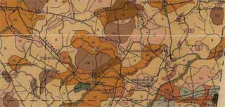
Old NC 10 was originally part of the Central Highway. Here is detail from a 1918 Orange County Soil map showing the road labeled as such. It also refers to the Old Fish Dam Road, which is an older road that ran along an Native American trading path from the Fish Dam village on the Neuse River (now under Falls Lake) to Hillsborough. For much more info on the history of Old Fish Dam Road, see the web page at the Eno River Association web-site.
 Detailed Map Full County Map (rootsweb)
This section of NC-10 crossed the mainline Durham to Hillsborough railroad twice. By 1925, NC-10 had been moved north of the railroad to the current US-70 to Bus US-70 through Hillsborough.
For the history of the transition in Orange County of NC-10 to current US-70, see this page.
 |
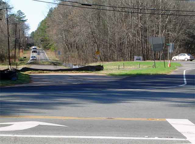
East End - US 70 near NC 751Old
NC 10 branches off of US 70 just west of where NC
751
ends. It obviously was once aligned with US 70, but now makes a turn
to make a T intersection with US 70, which curves off to the northwest.
In 2008, a turn lane was added to US 70 Business East for NC 751. The
construction uncovered original pavement of NC 10. Then the asphalt
covered up part of the old road. The remaining uncovered pavement shows
the old alignment. |
Norfolk Southern RailroadOld NC 10 gradually approaches and crosses the main
Amtrak
railline from
Durham to Hillsborough. The road bridge for the main line is a
treacherous S-curve. |
|
Old Murphey SchoolAccording to the Chapel Hill News 3/18/2009:
Tthe school is currently being renovated for use as nonprofit center.
The building was used as a school from 1923 to 1959. The auditorium
(center of picture) was built as a WPA project in 1936. Listed on the National
Register Study List Sites in Orange County in 1992. |
|
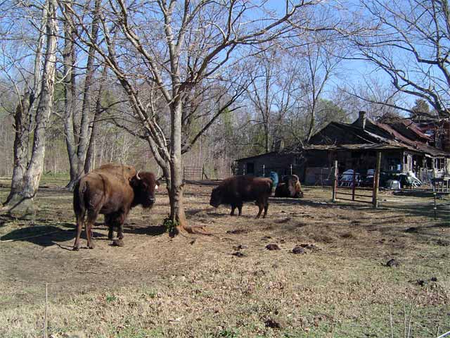
 | BuffaloAt the intersection of Cornwallis Road and Old Murphy School Road is an old farm that is now the home of a family of buffalo. This is about a quarter mile south of the old Murphy School on Old NC 10. |
Mount Herman Baptist ChurchEstablished
1848. The original church stood about a quarter mile north of the
current church, just north of the railroad. Not the original church
property has a sign for the church cemetery, though the cemetery itself
is across the road. See the detail in the 1918 map above. |
|
University StationBack when students came to the University of North Carolina by train, they changed from the main line to a train to campus at University Station. The bridge under the spur line is not nearly as bad as the bridge for the main line. The spur line is used for coal trains to the university power plant. |
|
Norfolk Southern RailroadThe road recrosses the railroad, again at a sharp S
curve. The
relocation of the highway north to current US 70 removes these curves
from the through highway. |
|
|
|
Cement PlantAs the road approaches Hillsborough, it becomes more
commercial. |
West End - NC 86The road appears to merge with NC 86, which is a newer
road.
Old NC 10 has to stop, but it has dual stop signs, including one on an
island, which is unusual. |
From downtown Hillsborough, NC-10 went west out West King Street. After crossing the railroad tracks, it turned onto current Ben Johnson Road at a crossroads just west of current Dimmock Mill road. This was part of the old Trading Path. From Ben Johnson it connected to current Dewey Road, which becomes West Ten, which carried NC-10 west to Mebane. After NC-10 was replaced with US-70, this section was the main route US-70. The current US-70 was Alt US-70 from Hillsborough to Haw River. Later, other changes eliminated the crossing of the railroad in the west side of Hillsborough and the widening of I-85/I-40 severed Dewey and West Ten from Ben Johnson Road.
 |
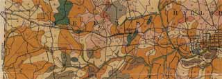
Here is detail from the 1918 Soils map that shows the route unlabelled.
 High Res Map Original County Map (rootsweb)
East EndWest Ten Road starts with a name change at the end of a connector road from US-70 to I-85/I-40, which goes under I-85/I-40 and ends at West Ten/Dewey. The old NC-10 route was on Dewey and West Ten. A half a mile east on Dewey, the road used to go under I-85/I-40, but the bridge was removed by the widening of I-85/I-40 during the 1990's. |
|
Rural RoadWest Ten is very rural. There is little there but farms.
Perhaps the only building surviving from the highway days is this
tobacco barn. On period maps, Cheeks Crossroads, due south of Efland,
was shown as a major town. Now, there is little there. Orange County is
planning to build a school complex on West Ten, which will bring some
traffic to this old road. |
|
| Historic
West End At this point, the old NC-10/US-70 routing veers left on Bowman Road. At the Alamance County Line, the road changes name to Old Hillsborough Road, which goes into the small historic community of Hawfields. West Ten Road continues right and curves north. According
to the 1918 map, the road to Hawfields was the paved mainroad. The
current West Ten Road was unpaved and left the current routing on a
northwest track directly to Mebane. This raises some doubt on what the
original route in 1919 of NC 10 at this point. |
|
West EndThe road crosses I-85/I-40 into an industrial park. At
the
Mebane city limits, it changes names. The final routing of NC 10 went into
Mebane and joined the route of current US-70 east of Mebane proper. |