Filpus Roadgeek - Point Lookout |
| |
|
|
|
This
section of NC-10 climbed Mount Bernard from Old Fort to Montreat. At
Point Lookout was a tourist stop overlooking the valley which was
called the Royal Gorge. A postcard showing Sandy the Bear at the
tourist trap is here.
It is
now gated off for pedestrian and bicycle use only. Gribblenation has a page
on this road. Postcards of Point Lookout: from the UNC library archives
can be viewed here,
from Genweb here.
A postcard of Andrews Geyser (north of Point Lookout) is here.
On October 20 2008, the road was formally opened to the public as Point Lookout Trail. A flagpole was raised at the old Point Lookout. The rest of this page was done before the trail was built.
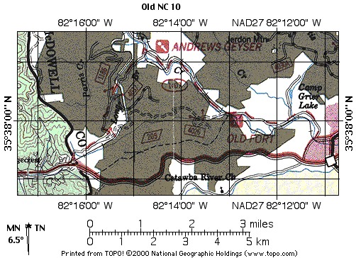 |
| Point Lookout - Area Map (high-res) |
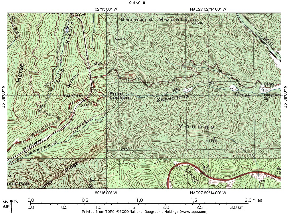 |
| Detail Map - (high-res) |
| Point | Mileage (mi) |
Elevation (ft) | Notes |
| Start | 0.0 | 1690 | Park by Piney Grove Church. Unmarked gate on the road. |
| Jeep Trail | 0.2 | 1732 | Access to National Forest Lands. Posted no motorized vehicles. |
| Tunnel | 2.47 | 2327 | East end of railroad tunnel 1. The entrance is above the road and not visible directly from the road. There is an access trail up from the road to the railroad tracks. |
| Point Lookout | 2.55 | 2280 | The site of the old tourist scenic overlook from the road. The topo map shows a building there, which no longer exists. |
| Tunnel | 2.80 | 2452 | West end of railroad tunnel 1. The entrance is directly below the road. It has obscured visibility from the road. The road now passes out of National Forest land onto private property. This is not marked here, but the gate at the west end is clearly marked. |
| Tunnel | 3.06 | 2440 | East end of railroad tunnel 2. Clearly visible from the road. |
| Tunnel | 3.10 | 2471 | West end of railroad tunnel 2. Not visible directly from the road. |
| End | 3.52 | 2563 | Gate on Old US 70 marked Private Property - No Trespassing |
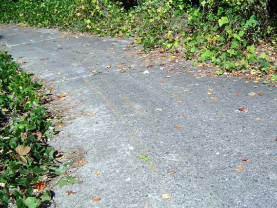 |
This road stills has original concrete pavement. Some of the pavement has an asphalt overlay. Other pavement has asphalt patches. This photo shows the double yellow centerline still visible on the road below Point Lookout. Below Point Lookout, the centerline is white. |
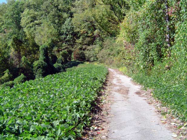  |
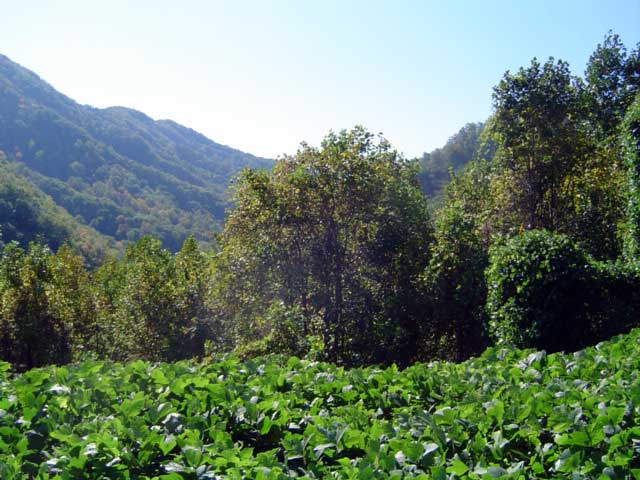
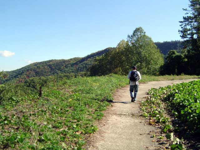
Sections that have no forest cover are overgrown with kudzu. This view and the panorama below appear to be from the same location as the postcard from Gribblenation. |
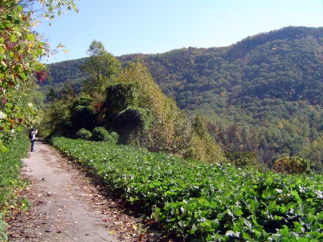 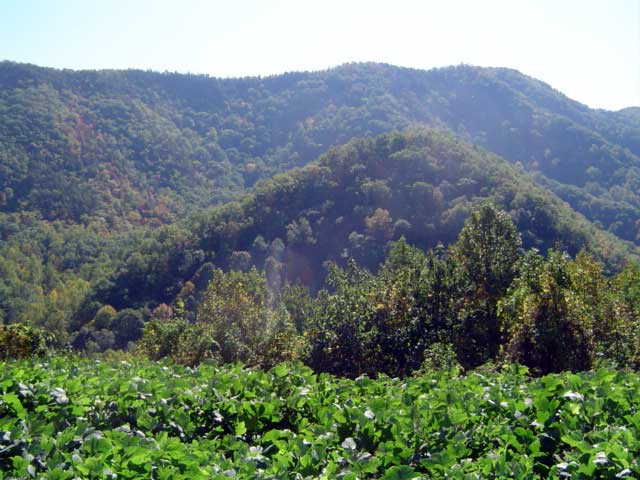  |
Panorama from the road of the Royal Gorge. |
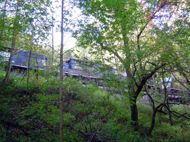 |
A train passing above us from the east entrance of railroad tunnel 1. |
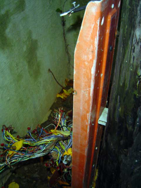 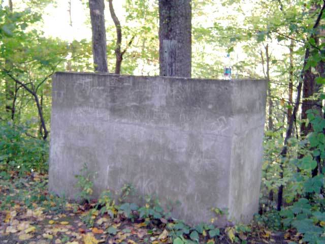 |
One vestige of modernity. This concrete vault protects an now nonfunctional telephone distribution block (in left photo). |
 |
Point Lookout. There was a building on the left, probably on pillars. |
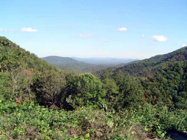  |
The view from Point Lookout. This vantage looks due east toward Old Fort and Morganton. This view is also seen in the postcard from Gribblenation. |
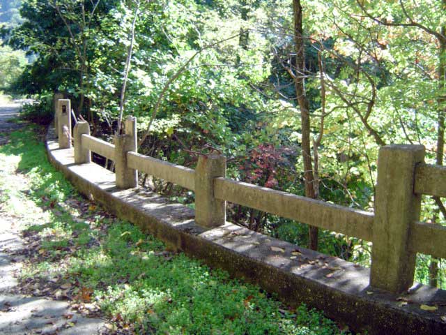  |
An old concrete railing over the west entrance of railroad tunnel 1. This railing is also seen in the postcard on Gribblenation. |
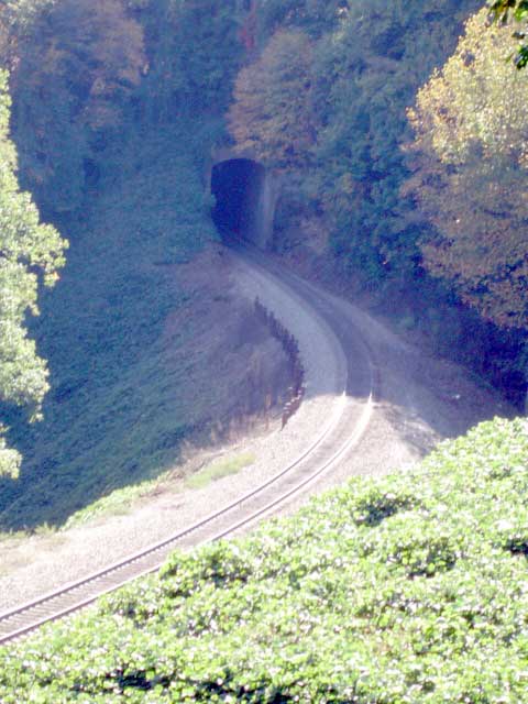 |
The east entrance of railroad tunnel 2. |
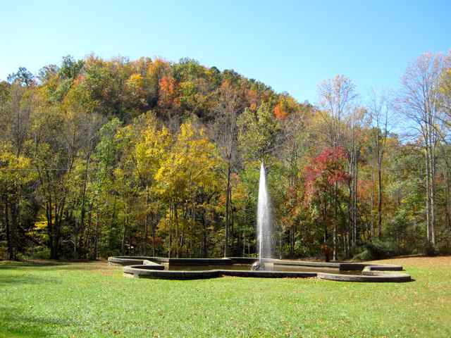 |
A couple of miles north of
the east end of the trail on Old US 70 is one of North Carolina's
curiosites. The fountain is the Andrews Geyser, named after a railroad
executive. It was built by the railroad in 1885 to memorialize the 120
men who died building the railroad over Black Mountain. The geyser was
built within a hairpin curve of the railroad, so it could be seen from
the trains from multiple angles. There was a hotel next to the railroad
overlooking the fountain, but it burned in 1903. The fountain is
gravity fed from a lake built up on the mountain by the railroad for
that purpose. The lake is now the location of the Inn on Mill Creek.
After the geyser, Mill Creek Road becomes a gravel road over Black
Mountain to the west end of the trail. |